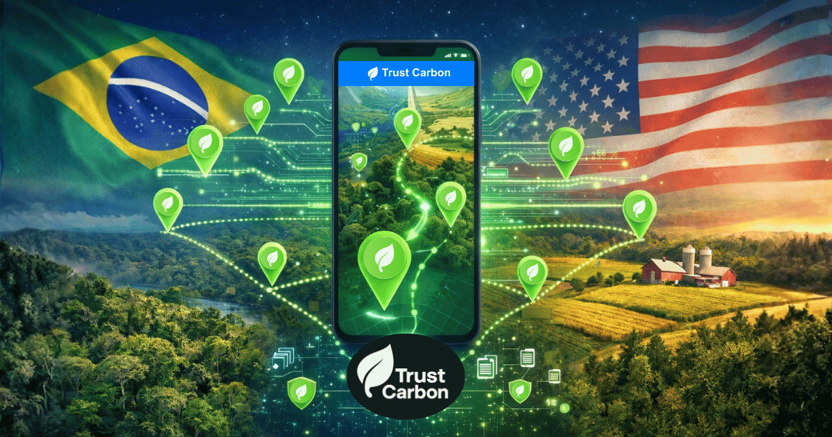
Carbon verification has a coverage problem and an integrity problem. Satellites can't see through closed canopy. External audit teams are expensive and slow. And the data trails buyers, certifiers and regulators need are usually opaque. The Trust Carbon Infrastructure is the digital layer that fixes both — AI-powered, offline-first, community-driven, from canopy to credit. It now spans three continents: 3.4 million parcels mapped across 27 U.S. states, 8.2 million SICAR farms across all 27 Brazilian states, and 515,000 properties across all 9 South African provinces — 12.1 million properties in total.
What Trust Carbon is: the digital infrastructure for carbon credit verification — community-led ground-truth combined with satellite imagery, with on-device IPCC Tier 2/3 uncertainty and 8+ security layers. What it isn't: a certifier, a broker, a marketplace, a consultancy, or a satellite-only solution. Credit issuance stays with Verra Carbon Standard, Gold Standard, ACR and other recognized bodies.
How It Works: Community Ground-Truth + Satellite Imagery
Trust Carbon does not replace satellites — it fuses them with community-collected field evidence. Satellites (Planet, Sentinel, Landsat) provide continuous landscape-scale monitoring; the smartphone is where ground-truth gets captured. Here's the actual process:
Download & Auto-Detection
The farmer or community field user downloads the app. GPS auto-detects location and looks up the parcel against jurisdictional registries: U.S. county parcel data (3.4M parcels across 27 of 51 states), Brazil's SICAR (8.2M farms across all 27 states), or South Africa's deeds registry (515K properties across all 9 provinces). 12.1 million properties are already in the system.
AI Checkpoint Generation
Based on traditional verifier methodology, AI analyzes the property and places strategic checkpoints inside it. Statistical stratification ensures proper coverage — typically 20 checkpoints per 20 hectares.
GPS-Guided Navigation
Like a GPS navigator, the app guides the farmer to each checkpoint. Voice commands announce directions and next steps — no reading required. Works 100% offline.
360° Capture at Checkpoints
At each checkpoint, the farmer captures 360° geotagged photos/videos, takes tree measurements, and follows AI-guided verification steps. Everything is time-stamped and device-signed.
Upload & AI Analysis
When back online, data uploads automatically. AI processes the evidence, cross-references with jurisdictional parcel data, runs 8+ security checks, and generates the verification report — visible to the project's chosen certifier through the dashboard and to investors and regulators through the REST API.
Why Ground-Truth + Satellite Beats Satellite Alone
Satellites can monitor change at landscape scale, but they cannot see beneath a closed canopy, identify species, or confirm that a specific intervention actually happened. That is why pure remote-sensing approaches have historically needed expensive ground audits. The Trust Carbon Infrastructure makes ground-truth scalable.
| Aspect | Traditional (Satellite + External Auditor) | Trust Carbon Infrastructure |
|---|---|---|
| Who collects ground data | External audit team flies in | Local farmers and community field teams |
| Cost per property | High (audit-team economics) | Scales from 5 ha to 100,000+ ha |
| Under-canopy evidence | Not possible via satellite alone | Geo-tagged 360° captured at AI-placed checkpoints |
| Language & accessibility | Typically English; literacy-dependent | 17 languages; voice-guided; works for low-literacy users |
| Internet required in the field | Generally yes | No — offline-first by design |
| Anti-fraud controls | Manual review, post-hoc | 8+ security layers; on-device AI audit; real GPS, camera authenticity, immutable timestamps |
| Uncertainty accounting | Manual, project-by-project | IPCC Tier 2/3, on-device |
| API for certifiers, investors, governments | Typically none | REST API with token authentication, webhooks, rate limits |
The U.S. Coverage in Numbers
In the United States the infrastructure ingests county-level parcel data and federal land-cover layers, refreshed on a rolling cadence so that on-the-ground checks always run against current data — not an annual snapshot.
USA Coverage
Live as of May 2026
The same pattern was originally built for Brazil's SICAR, where the federal Rural Environmental Registry is technically fragmented across thousands of municipalities. Trust Carbon's resilient mirror covers all 27 Brazilian states (8.2M farms, 721M ha). And in South Africa, parcel data from all 9 provinces (515K properties, 208M ha) is mapped and queryable through the same interface. One unified property model across three continents.
Accessibility: Voice-Guided for Everyone
A key innovation is complete voice accessibility. Many farmers in rural areas have limited literacy. Trust Carbon's AI announces via voice commands exactly what to do at each step:
- "Walk 50 meters north to the next checkpoint" — GPS navigation with voice directions
- "Hold your phone at chest height and rotate slowly" — 360° capture instructions
- "Measure the tree trunk at 1.3 meters height" — Data collection guidance
- "Checkpoint complete. 4 remaining." — Progress updates
The app is available in 17 languages and designed so that anyone — regardless of education level — can complete professional-grade environmental verification.
8+ Security Layers: Trust, Then Verify
Community-led verification only works if every submission is tamper-evident by default. The Trust Carbon Infrastructure ships with 8+ security layers running on every device, every session, every checkpoint:
What Trust Carbon Collects
The platform enables comprehensive environmental verification for carbon credits and agriculture:
- Carbon sequestration: Vegetation health, tree measurements, biomass estimation
- Land use compliance: Protected buffer verification, land cover analysis
- Agricultural practices: Sustainable farming documentation, regenerative practices
- Biodiversity: Integration with Abiental Geospace for species documentation
Each verification creates a tamper-evident audit trail with confidence scores and reproducible methods — enabling transparent review and replication.
Inclusive Access for Smallholders, Developers, Certifiers and Governments
Most smallholder farms in the world are below five hectares — and they are the population that legacy MRV economics priced out of carbon verification entirely. The Trust Carbon Infrastructure is designed to invert that: the same workflow scales from the smallest project to the largest, with a tier appropriate to each actor.
- Smallholders & communities: offline-first app, 17 languages, on-device IPCC Tier 2/3. Any smartphone becomes a scientific data-collection instrument; smallholders typically join aggregated projects led by developers or cooperatives.
- Project developers (5 ha to 100,000+ ha): setup wizard, AI methodology recommendations, dedicated dashboards, direct integration with the certification body chosen by the developer.
- Certification bodies: a console to adapt or publish methodologies (Verra Carbon Standard, Gold Standard, or new ones) directly into the infrastructure.
- Investors, funds and governments: a REST API with token authentication, webhooks and rate limiting — for programmatic access to verification records and audit trails. Useful for due diligence under UNFCCC Article 6.2 / 6.4, the VCMI Claims Code, and EU CBAM workflows.
USA + Brazil + South Africa: 12.1 Million Properties
Combined Coverage Across Three Continents
🇺🇸 United States Coverage
27 of 51 States Connected • 3.4M+ Parcels • 219M Hectares Indiana
1,706,284
Indiana
1,706,284
 Iowa
1,008,410
Iowa
1,008,410
 Texas
232,057
Texas
232,057
 Wisconsin
227,476
Wisconsin
227,476
 California
62,171
California
62,171
 Colorado
45,130
Colorado
45,130
 North Carolina
37,835
North Carolina
37,835
 Michigan
35,760
Michigan
35,760
 Florida
20,195
Florida
20,195
 Wyoming
16,569
Wyoming
16,569
 Oklahoma
10,164
Oklahoma
10,164
 Georgia
8,373
Georgia
8,373
 Kentucky
7,863
Kentucky
7,863
 Oregon
3,115
Oregon
3,115
 Alabama
2,692
Alabama
2,692
 Missouri
2,686
Missouri
2,686
 South Dakota
1,990
South Dakota
1,990
 Nebraska
1,862
Nebraska
1,862
 Massachusetts
1,517
Massachusetts
1,517
 Connecticut
1,475
Connecticut
1,475
 Tennessee
868
Tennessee
868
 Maine
431
Maine
431
 Idaho
285
Idaho
285
 Mississippi
210
Mississippi
210
 South Carolina
57
South Carolina
57
 North Dakota
27
North Dakota
27
🇧🇷 Brazil Coverage
27 of 27 States Connected • 8.2M Farms • 721M Hectares • SICAR Integration Pará
313,076
Pará
313,076
 Rondônia
161,188
Rondônia
161,188
 Tocantins
111,652
Tocantins
111,652
 Amazonas
101,927
Amazonas
101,927
 Acre
63,927
Acre
63,927
 Roraima
40,626
Roraima
40,626
 Amapá
35,884
Amapá
35,884
 Bahia
956,584
Bahia
956,584
 Ceará
557,226
Ceará
557,226
 Piauí
490,929
Piauí
490,929
 Pernambuco
414,588
Pernambuco
414,588
 Maranhão
389,188
Maranhão
389,188
 Paraíba
216,604
Paraíba
216,604
 Rio G. do Norte
147,966
Rio G. do Norte
147,966
 Alagoas
143,553
Alagoas
143,553
 Sergipe
87,633
Sergipe
87,633
 Minas Gerais
798,811
Minas Gerais
798,811
 São Paulo
533,799
São Paulo
533,799
 Espírito Santo
227,558
Espírito Santo
227,558
 Rio de Janeiro
222,542
Rio de Janeiro
222,542
 Rio G. do Sul
650,706
Rio G. do Sul
650,706
 Paraná
563,200
Paraná
563,200
 Santa Catarina
411,308
Santa Catarina
411,308
 Goiás
191,109
Goiás
191,109
 Mato Grosso
169,447
Mato Grosso
169,447
 Mato G. do Sul
121,981
Mato G. do Sul
121,981
 Distrito Federal
53,354
Distrito Federal
53,354
A Live Example: VM0033 Mangrove Restoration
A current production case running on the infrastructure: a VM0033 (mangrove restoration) project with 79 plots verified across 88.3 hectares. Mangroves are notoriously hard to verify from space — tidal flooding, low canopy, mixed species — which is exactly the kind of context where community ground-truth makes a credit defensible. Every plot has geo-tagged photo/video evidence, IPCC Tier 2/3 uncertainty bounds, and a public audit trail visible to the project's chosen certifier.
Recognition
- Top 5 Global Winner — DPI for People and Planet Innovation Challenge 2025. Selected from 540 startups across 73 countries. $100,000 prize. Backed by the Gates Foundation, BCG, JICA, Co-Develop, CDPI and COP30 Brazil.
- Selected for the Halcyon Global Climate Fellowship 2026 — six-month hybrid program in Washington DC and Los Angeles.
- Showcased at the Global DPI Summit, Cape Town (5 November 2025) and inside the COP30 Blue Zone, Belém, Brazil (Day 2, 11 November 2025).
- 90+ pilot projects across three continents, from 5 ha up to 100,000+ ha.
About the Founder
Brayon Pieske founded Trust Carbon in 2023 in Santa Catarina, Brazil, and now leads the company from Palo Alto, California. The Trust Carbon Infrastructure is patent pending and under license to PIESKE ONE LTDA.
Explore the Trust Carbon Infrastructure
See how the four pillars — Project Setup, Field Collection, Certification Bodies, and Investor Access — connect a single verification platform across three continents.
Learn More